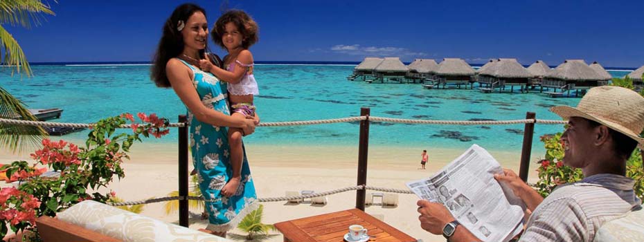
Hua hine is located 110 miles northwest of Tahiti and is just a Only just a 30-minute flight from Tahiti on Air Tahiti, Tahiti’s inter-island carrier. Actually consisting of two islands joined by a bridge, the magic of Huahine can be felt instantly upon arrival, and the proud locals do their best to make all visitors feel welcome. (The main town is Maeva – which means welcome in Tahitian!) A 20-mile road winds through the island, passing through small villages and climbing high into the hills for spectacular views of the white-sand beaches and brilliant turquoise lagoons.
Restored Tahitian marae (temples) and centuries-old stone fish traps reflect the island’s ancient culture and proud descendants who still reside in this magnificent paradise. Huahine is an agricultural island, rich with watermelons and cantaloupes. Vanilla, coffee and taro plantations are plentiful, as are groves of breadfruit, mango, banana, papaya and flowers. International surfing champions seek the world-class waves at Avamoa Pass, and the world’s largest outrigger canoe race, the Hawaiki Nui Va’a, begins here each October. Huahine is sparsely populated, and visitors will fall in love with the remote, unspoiled scenery and relaxed pace of this island.
Sightseeing on Huahine
-
Ariiura Garden Paradise
Garden of traditional and medicinal plants. Each plant or tree is identified with its Latin name. Garden of health and life, fill yourself with our culture and our traditional knowledge of plants.
-
Archaeological site of Maeva
The administrative centre of Fare, on Huahine Nui, is a pleasant port and quiet village located at the foot of Mount Turi (669 m).
Its airport, on the northern part of the island which reaches out to sea, borders Lake Fauna Nui, opposite the famous archaeological site of Maeva. This village was the seat of the island’s eight chieftainships and the royal “marae”, the first of which was protected by fortifications. This interesting collection of aligned stone slabs, paving and terraced platforms, spread out between the lake and the foothills, is further enhanced by ancient fi shing nets and an oval shaped “fare pote’e” (meeting hut). The road continues towards the village of Faie, known for its eared eels considered sacred by the villagers who feed them. The road forks off inland across the slopes of Mount Turi, towards the southern part of the island and the converted Belvédère, which looks out over the beautiful village of Maroe and its bay.
-
Mount Turi
Admire the taro (tuber species) and vanilla plantations along the way, before arriving in the village of Fitii, tucked away in a bay. For those not ready to return to Fare, the road continues towards Huahine Iti, smaller and less populated, by crossing the bridge which separates the two large bays of Maroe to the east and Bourayne to the west. Stop at the village of Maroe to admire the spectacular view of Huahine Nui, including Mount Turi and, towards the west, the imposing mountainous silhouette of the god Hiro’s paddle.
On the east coast, the village of Tefarerii harks back to bygone splendors, when it was a residence for the Pomare royal family. Today its people grow various types of melon on the neighbouring “motu”.
The southern part of the island, near Parea, boasts a beautiful white sandy beach and pristine lagoon.

